709-218-7927 The Landfall Garden House 60 Canon Bayley Road CANADA A0C 1B0 |
|---|
Taylor Creek Park
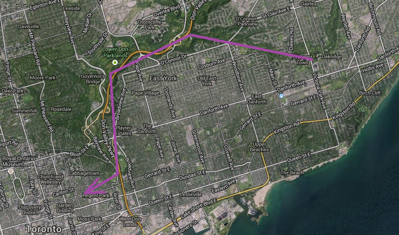
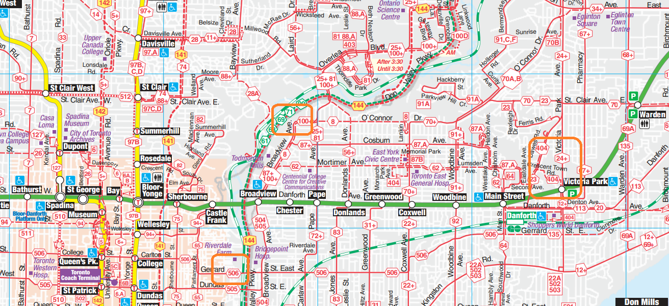
I set off to walk from Victoria Park Subway station to Gerrard Street along Taylor Creek and the Don River.
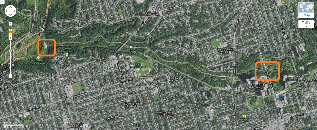
My starting point is enclosed in the orange rectangle at the right-hand side of the map above. Victoria Park Subway station is the thin rectangle between my orange square and the Danforth Avenue.
On the left of the map is a parking lot at the western end of Taylor Creek Park.
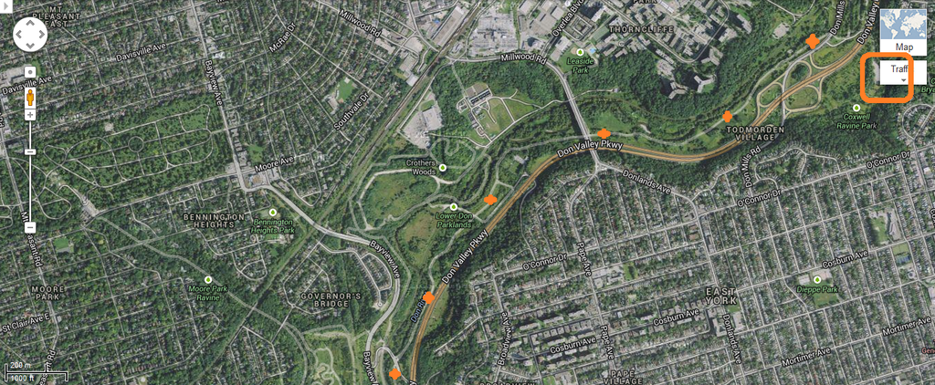
I continued in a south-westerly trend from the car park (upper right corner of the map above) under the Don Valley Parkway, then keeping the Don Valley Parkway close to my left-hand side as I walked downstream.

I continued in a southerly trend, keeping the Don Valley Parkway close to my left-hand side as I walked downstream.
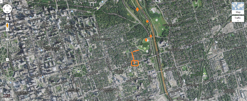
I continued in a southerly trend downstream until I reached the footbridge that crosses into Riverdale Park, made my way up the hill, then down Sumach Street to Gerrard Street, where I caught a streetcar home.
If I do this walk again I shall pay especial attention to those points where I can ascend out of the valley and catch a TTC bus, streetcar or subway train!
It is a long walk, and once you are “trapped” between the Don valley parkway and the Don River, you just have to keep walking!
On the map above I have marked my start- and end-points and the car park partway through.
Here is the entrance to the park from the west side of Victoria Park Avenue north of the subway station.
I wish the sign was larger.
On my way down the steps a flash of brown with a long tail caught my eye. A fox, I thought, but as I turned around it looked more like a gopher peering out of its burrow.
At the foot of the steps I see a bike path coming down from Victoria Park Avenue.
Here is a map of Taylor Creek Park. “You are here” says the red dot at the right-hand side; I am going to the car park at the left hand side of the map.
There are many access points in this park, steps mostly, going up to roads that cross the valley.
The bridges are awe-ful.
Wild violets grow along the paths.
And here I am at the western end of Taylor Creek Park.
Be careful; at the southern end of the car park there appears to be a path that heads south – where we want to go.
But to get southwards down the Don River we have to exit the northern end of the car park, go underneath the Don Valley Parkway, and then loop south.
Avoid the large concrete bridge; it won’t take us where we want to go; bear left for best results!
Here I am sheltering from the rain in a Henry Moore-like sculpture. My plan is to make for Rosedale Valley road, which comes down BEHIND the cluster of apartment buildings and emerges to the left (south) of them.
And so I pass from Taylor Creek Park into the Don River parks.
Here Taylor Creek flows into the Don River.
The Don is still delightful at this point, with many rapids and a few man-made weirs.
I found a Bulgarian family picking nettles to dry for tea. Be careful. The nettles are coated with a toxin that stings. The family was using plastic bags as gloves. I touched (not even grabbed) a stem and could feel the burn hours later.
More bridges span the river. I think that this is Millwood Road.
It sure is impressive. That’s a yellow cube van heading westwards against the threat of the next rain shower.
As I draw closer the structure grows more impressive.
This didn’t come out too well, but as I walked underneath I was impressed by the details of the structure.
This is a much better shot. Makes me want to rush out and buy a metal Meccano set!
The paths make me think of roads in medieval times. To be sure there was no use of asphalt, but the track winding along the banks of the river and the travelers up and down made me feel as if I were walking in the Olden Days.
If you ever feel like flattening pennies on the rails, here’s an opportune place.
I think this is the crossing of Pottery Road. The wavy blue markings are fun.
A pedestrian island makes it easier to cross the road, one direction at a time.
The cyclist has waited for the northbound car to pass.
I thought I had reached the foot of Rosedale Valley Road; my feet were beginning to ache. But no! This was just the Bayview Road junction.
Sigh.
Here is a glimpse of Evergreen and, I think, the arts-museum-craft centre at
I approach the Bloor Street viaduct. I live just fifteen minutes south of Bloor Street, albeit a tad to the west of here, but the sight of Bloor Street gave me courage.
A closer view, showing the subway train’s avenue underneath the road deck.
At last! Riverdale Park! All I have to do is climb three flights of steps, walk across the bridge, down the other side,, across the park, up a steep ramp ...
I can see the Aura building, a landmark of my home district.
And here is a view of the ramp p which my aching legs must lift me.
After crossing the bridge I found the path around the park is under water.
As is a large part of the park.
As I walked to Sumach street I rescued two large plastic pots from yard waste piled outside a house.
Here they are, riding home with me on the streetcar.
17,000+ steps, and it feels like it.
Loading
709 218 7927 CPRGreaves@gmail.com
Bonavista, Monday, June 01, 2020 2:54 PM
Copyright © 1996-2020 Chris Greaves. All Rights Reserved.