Friday, October 14, 2016
Please take a moment to download and read my file Fully Funded Public Transit .
I have made this page after sifting through my paper souvenirs. Iíll probably just end up repeating myself ...

This is a map of Poissy taken from the garbage collection schedules. You can see that Poissy began on the river bank and has spread east-west, but NOT along the river-bank. My guess is that the river-bank was quickly given over to industry and the residences were inland, then when the industry died, the residential district was too well-established inland to move towards the river-bank.
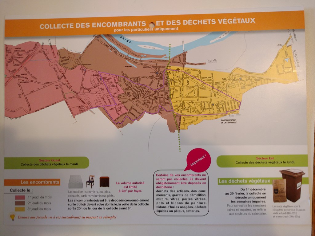
Here is the same map, same scale, with my walk of Saturday, September 17, 2016 superimposed, faintly, in purple. I walked in a clock-wise sense around town.
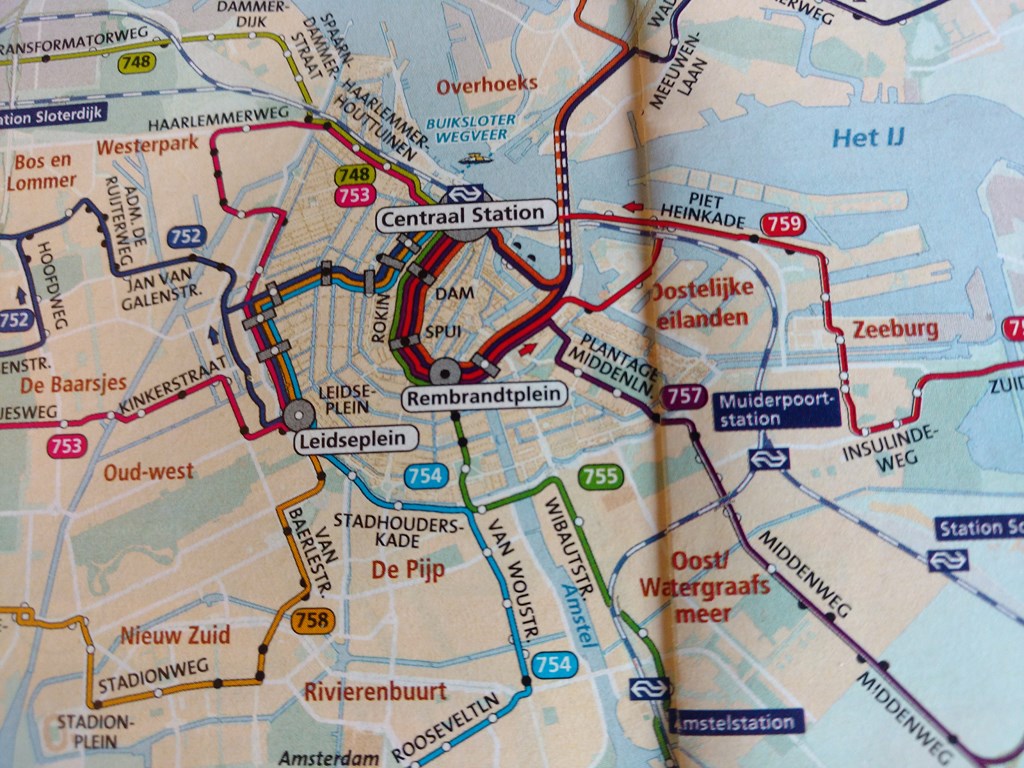
A segment of the transit map for downtown Amsterdam, showing the canals which served as concentric moats, and the radial arms which connect the arcs.
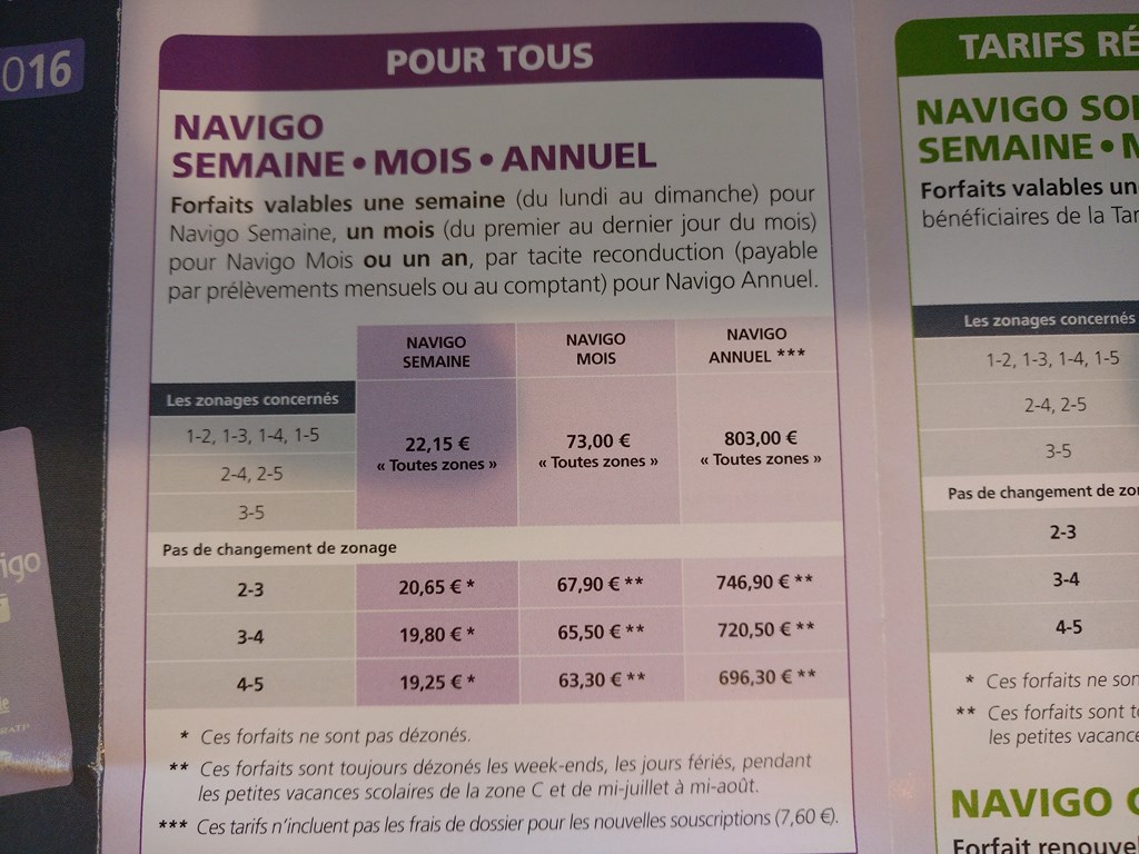
I did not qualify for a seniorís rate, having no French Pensionerís card. (Yet!), so I paid the full fare, seventy-three Euros for a monthís travel which lasted three weeks.
Even at Ä73 it is still a better deal than a Toronto Transit Commission pass which takes me only as far as Steeles Avenue!
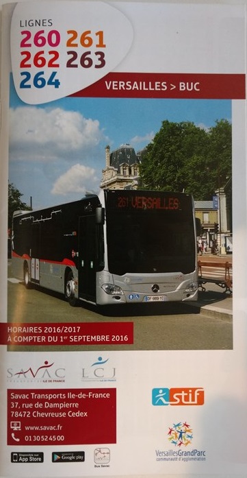
The front cover of a booklet for bus routes around Versailles. Each major town has a different local supplier who provides a different type of schedule. Versailles with its booklet is one form of data for the traveler.
This booklet serves towns south of Versailles.
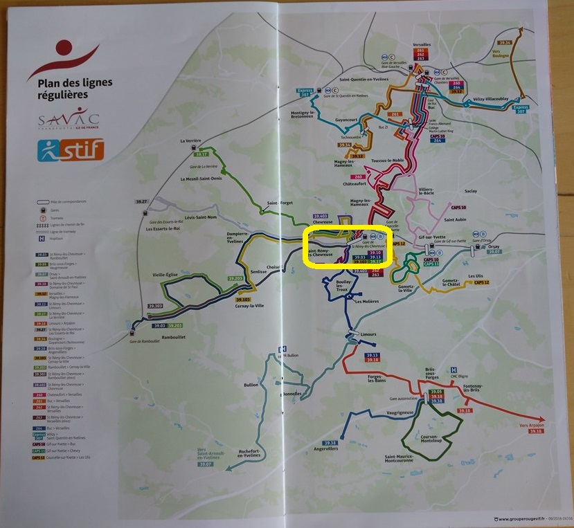
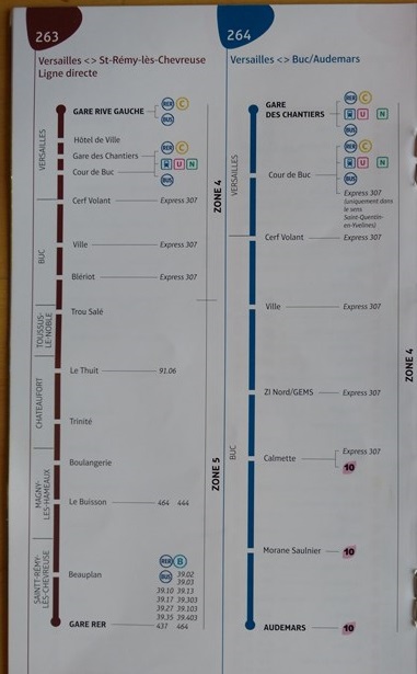
The booklet includes an overall ìto scaleî map. I rode the 262, I think, from Versailles at the top of the photo, to Saint Remy les Chevreuse, circled in the centre of the map.
For each route in the booklet there is a strip-map showing bus-stops and interconnecting routes. In the station at Saint Remy you can hop on the RER line ìBî and high-tail it back to Paris (but I would spend a bit of time in Gif Sur Yvette) or you can catch any one of a dozen local buses around Saint Remy, and so it goes, daisy-chaining from one town to another.
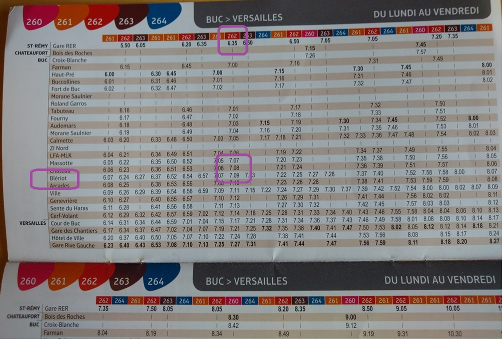
For each route in the booklet there is a time-table which allows me to predict the bus-stop (not the town!) we are going to be in one minute from now! If I am on the 6:35 from Saint Remy and the bus clock shows the time as 7:08, then we will pull up at the bus-stop BlÈriot (if requested) one minute from now.
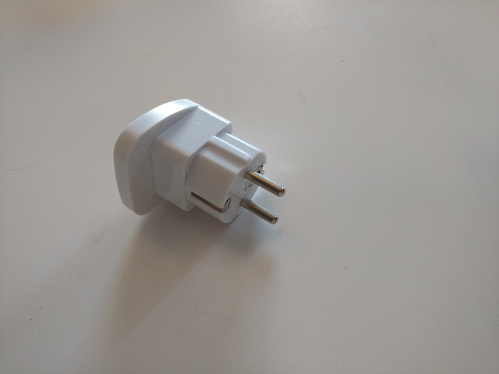
If you are travelling around France, make sure you buy a plug that has the two cylindrical male prongs. That is what needs to slide into the wall in your hotel.
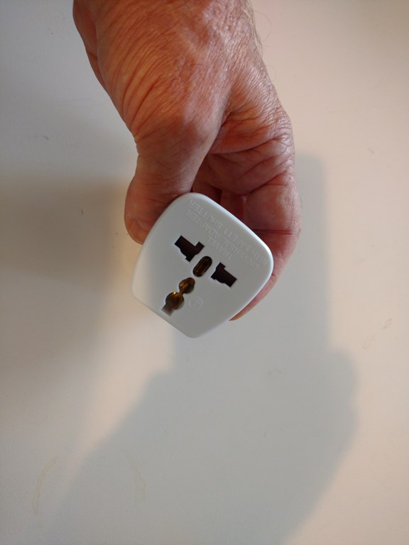
I generously left my first adapter in HÙtel Quatier Bercy as a gift, two years ago. This time I brought the adapter home with me. If you want to borrow it ...
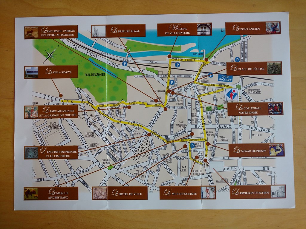
A tourist map of Poissy with pointers to historical sites.
The truth is that Poissy is a historic town, and every fifty yards seems to show a facet of its history, right up to the August 1944 bombing.
HÙtel ibis is on the round-point adjacent to the Information symbol, top-right of this map.
I recommend HÙtel ibis and would book into one of their hotels for my next trip.
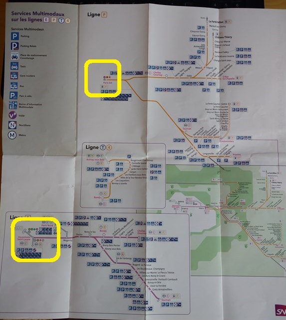
Another neat map. This one shows the suburban lines serving areas East of Paris. I have circled in bright yellow Gares Paris Est and St Lazare.
Just photographing this one map makes me want to hop on a plane and explore every town and village served on this map, and to start each conversation with ìBonjour!î and to end each conversation with ìBonne JournÈe!î.
Sigh.
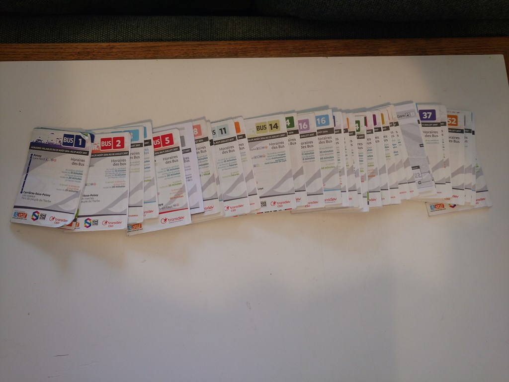
My collection of 31 mini-schedules, and even then I didnít get the whole set from Poissy. My collection includes mini-schedules from other towns and cities. It looks like a stack of Monopoly property cards.
Mini-schedules vary in size. Simple routes might by three-ply while busy or complex routes might be 8-ply.
I learned to rely on these schedules, after a couple of mistakes in interpreting them. They are compact (shirt-pocket) and robust.
My biggest problem with them was that they are racked in different places according to the bus service, and when I was boarding I was too intent on tapping my Navigo Card and making sure that it registered to scan the entrance-way of the bus.
On many occasions the bus-driver gave me his own personal copy (!) or pulled a copy out of his little satchel. That is, sometimes you just have to ask. ìThe answer is ënoí unless you askî.
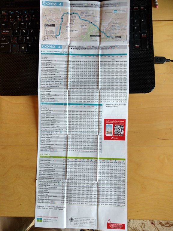
This is one face of the mini-schedule for the 4-express out of Poissy. It has five folded rows, three folded columns, and two faces, so a total of sixty pages.
I found the strip map to be as useful as my Michelin maps in terms of determining my position along the route.
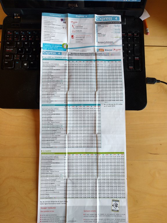
Here is the reverse face, another thirty pages, mainly bus-stop times. Every bus stop for every departure on the route. Weekdays, weekends, school holidays, ...
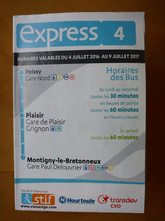
The main cover tells me that this is indeed a way to get to Montigny-le-Bretonneux. At the time I boarded I had no idea that we were going to St Quentin en Yvelines, but the fact that the three major points are labeled ìGareî tells me that I will never be far away from the IlÍ de Franceís RER train system should I want to get home quickly at the end of the day.