416-993-4953 32 Grenville Street M4Y 1A3 |
|
|---|
.JPG)
How Do You Locate Potential Spots?
I start with Google Maps and Google Earth, Windows Explorer and MSPaint. The last two tools come with Windows XP; the first two are free downloads from Google.
If I am visiting several potential launch spots I’ll travel by car out to the furthest spot, noting odometer readings and photographing every turn off from the main route on the way out; on the way back, I’ll visit the spots in reverse sequence. In this way the odometer readings are consecutive on the way out. As well, if I do run short of time, at least I’ve got the furthest spots tagged.
I start in a general area we'd like to travel. In this case we are considering another overnight trip as we did for the Oxtongue River and Oxtongue Lake , but in the Huntsville area:
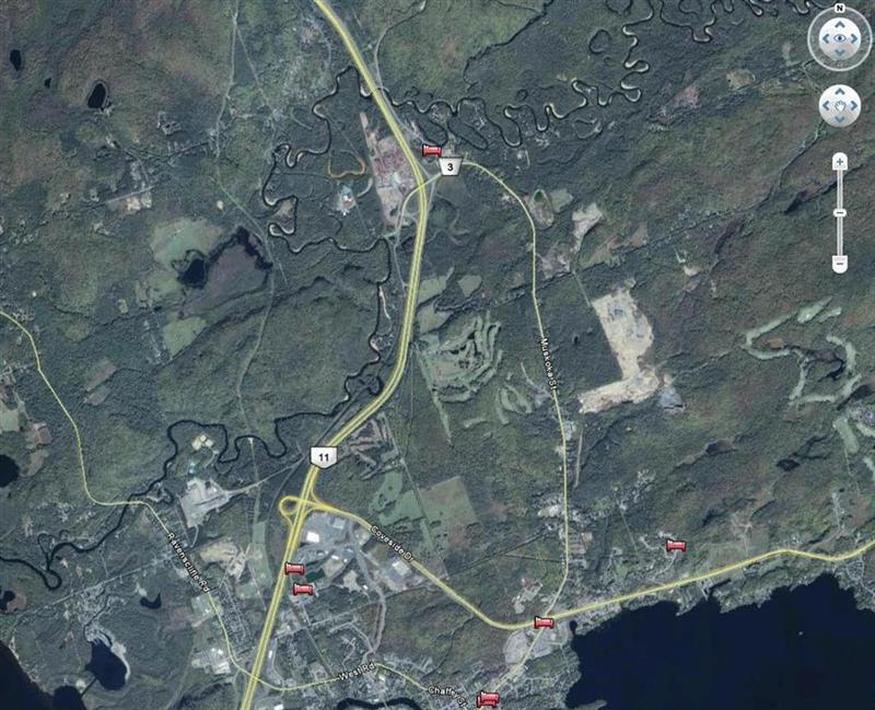
In the screen shot above you can see that with Google Earth I have ascertained that there is a winding creek just north of Huntsville; that's Huntsville town in the lower part of the shot.
I elected to show Accommodation in Google Earth, and we are assured there are plenty of motels etc. in the area.
Google Maps tells me that the creek wanders through the Arrowhead provincial park. A good sign that it might be a quiet little spot.
When I zoom in the area near the motel north of Huntsville (intersection of Highway 11 and #3) I notice that each meander of the creek has sandy banks – they are the light-colored crescents on the screenshot.
My geography teacher Mr. De Kurloi taught us that meanders generally mean slow-flowing, and the sandy banks tell me that the river is flowing too slowly to carry much heavy sediment.
A trailer park is in evidence, and off-season these places will often allow us to launch and park the car out of the way.
Failing that the motel might advise us of a good launch spot.
A little further south I spot what might be a launch spot adjacent to an industrial (hence quiet on weekends) area, on Old North Road.
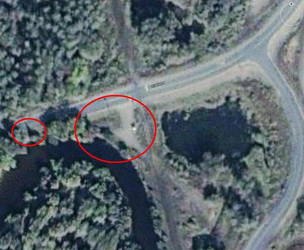
What I took to be a parked car now looks like a small hut or gatehouse. The parking area is large. Is that a house?
Fifty yards East of there is another potential launch spot, but again, I have doubts. That might be a house nestling under the trees.
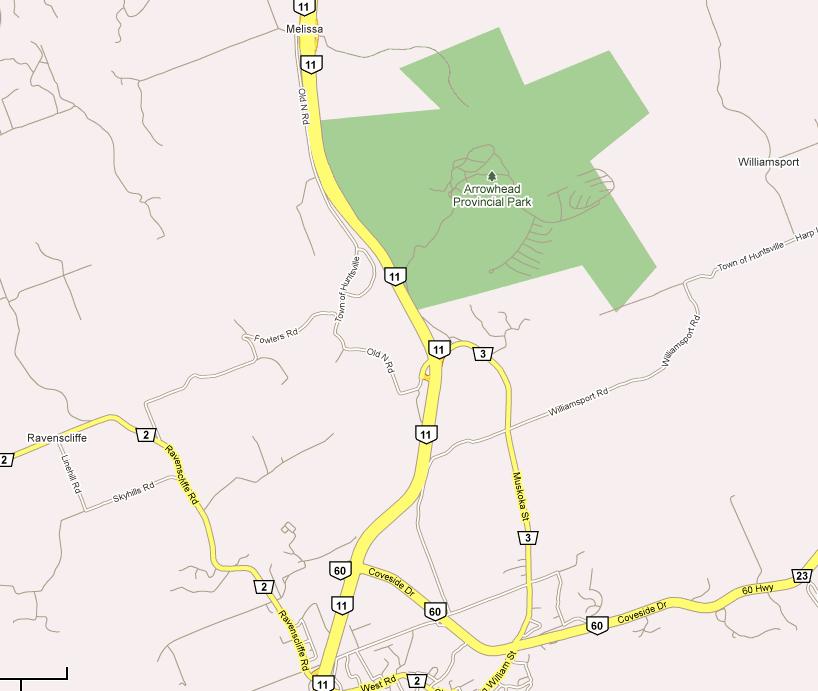
Still in zoom mode in Google Earth I follow the track Old North Road as it runs south between Highway 11 and the railway tracks.
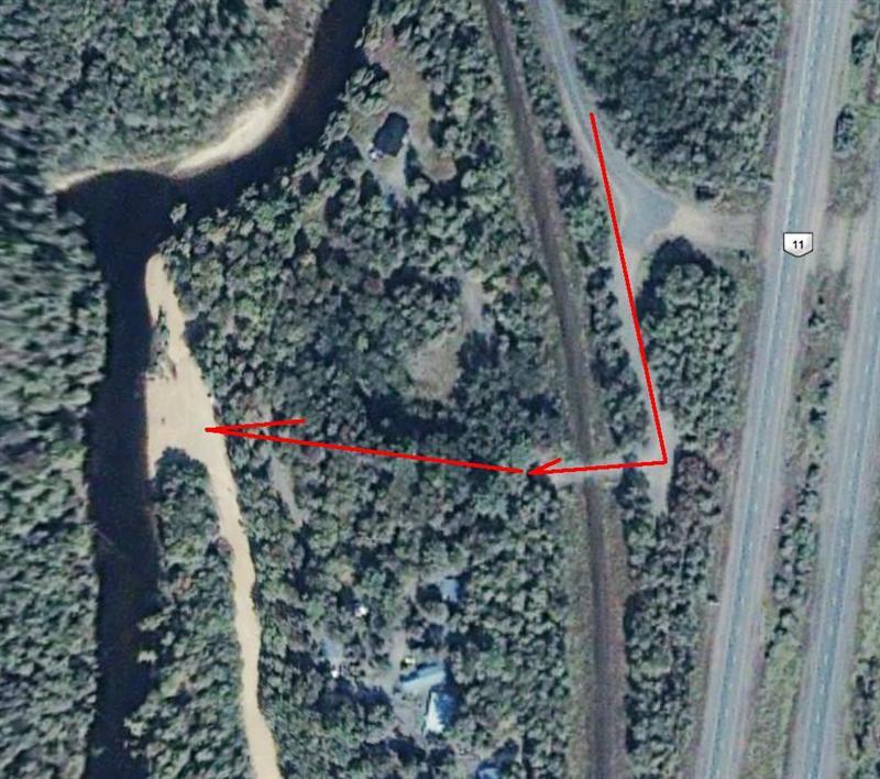
Both Google Maps (in Map, not satellite mode) and Google earth show that this road ceases to be a public road
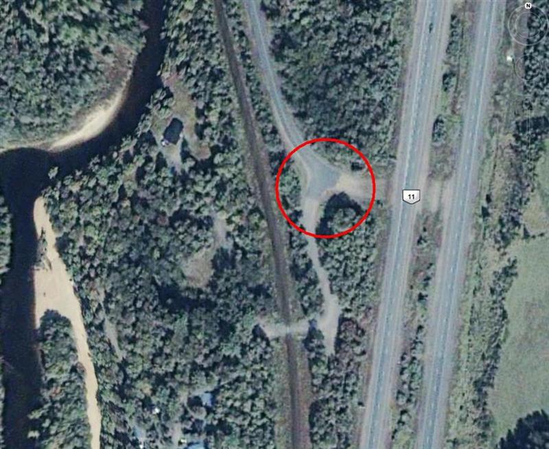
In Google Earth the sealed road ceases.

In Google Maps the road just ENDS!
None the less I figure that there's a chance of a launch spot once we cross the tracks; there will be a trail under the trees.
Of course we will ask permission of any available householders.
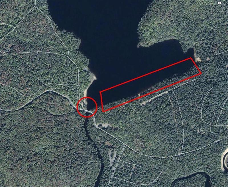
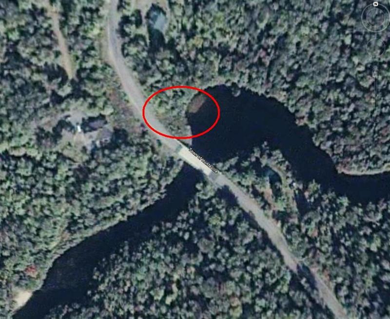
Following the creek North brings me to a place where the road crosses the creek.
There seems to be a jetty north of the road, but the straight-line to the east suggests that this is a man-made structure – a dam.
The creek feeding into the dam (from the North-West) might be too narrow to enjoy, but if we can make it we may be blessed with much wild life.
The dam appears to be too small to be involved with flood control or large releases of water.
(But for small weirs please read “ Beaver River (Beaverton) ”)
The lake is within the park boundaries, so there will probably be an entrance fee.
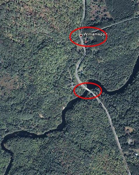
Further up stream, and east of the park boundary lies Williamsport, and a bridge over the creek.
Bridges often offer a parking spot on the shoulder and a launch spot after a 50-yard carry.
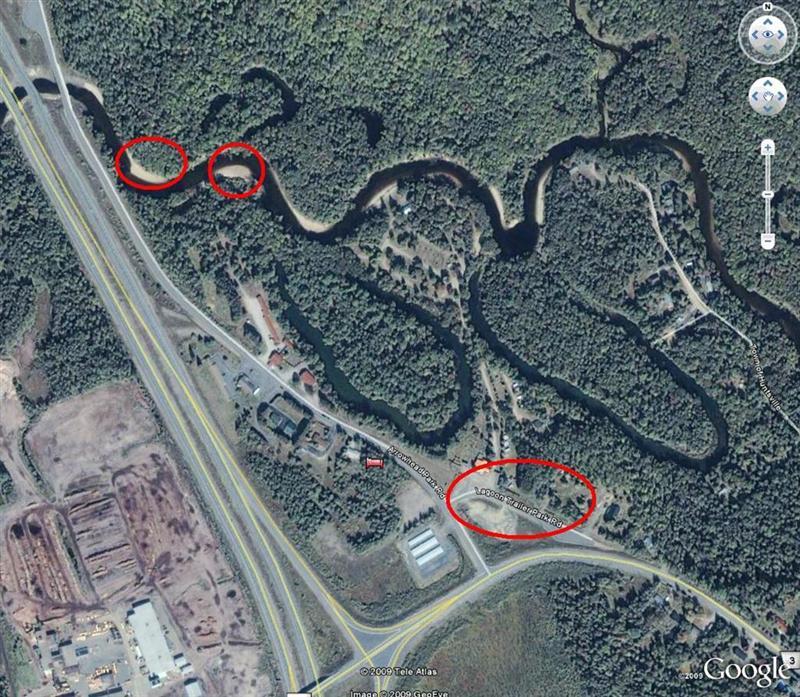
I decide to zoom in:
In no way does there appear to be an earth shoulder developing into a track down to the river.
If I had to bet, I'd go for the North-east shoulder of the bridge, but I am hesitant about parking on the shoulder near a blind curve. Not a smart move!
And so it goes.
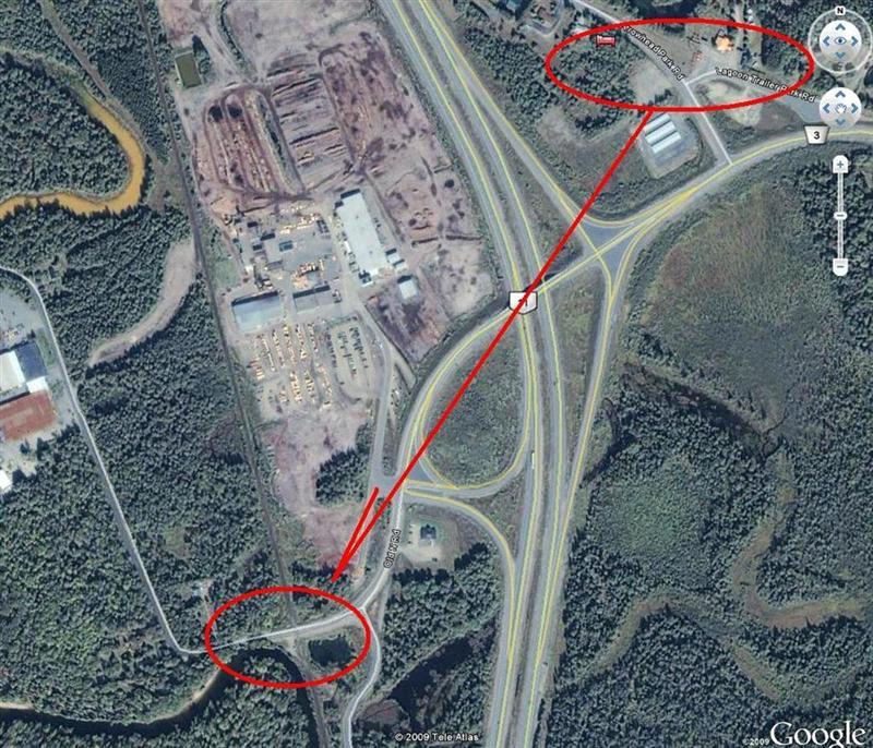
I proceed to drag Google Earth upstream, zooming in at likely spots, confirming the publicity of roads with Google Maps.
Here's an Exercise for You
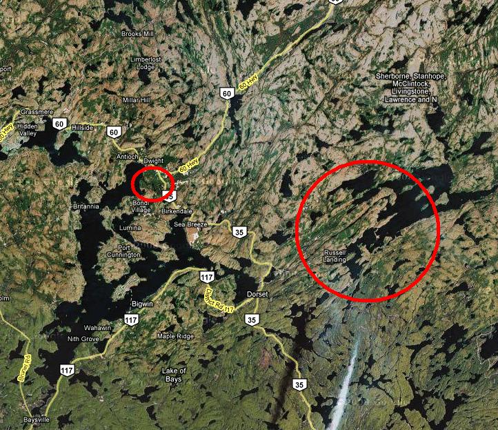
I zoom out and spot "Russells Landing" just a little east of Dwight. Even less east of Dorset.
Now we stayed at a lovely motel in Dwight last year when we did Oxtounge River and Oxtongue Lake .
As you zoom in (Google Maps) to Russells Landing you'll see a rural road #8 leading off Highway 35.
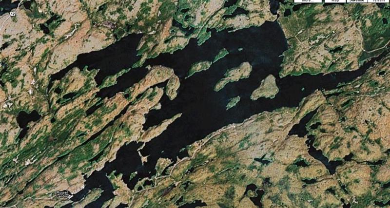
Google Maps will show the public road apparently ending at the label "Russells Landing", but if you continue to zoom in, in satellite mode you'll see what might be a marina or dock. Google Maps, in map view, does not show the body of water extending to the end of the road (lazy mapmakers!), but Google Earth does a better job.
I find that judicious use of both Google maps AND Google Earth gives me more data, and hence more information.
At this point you might search the web for marinas in Ontario associated with "Russells Landing".
"Russell Landing" Ontario is a good search term.
One of those hits will take you to "County of Halliburton Highlands", and if you search (Edit Find in your browser) for "Russell" you'll locate a reference to Old Mill Marina (Kawagama) Ltd with both a web site URL and a telephone number.
The web site hosts a great deal of information.
Your options now would be to email or telephone to enquire about a launch, or just motor on up there. We have not yet found a marina that is unwilling to let us park the car for a nominal fee and launch the canoe.
Given that we enjoyed our stay at Dwight last year, this looks like a good candidate for an overnighter.
What Else can we Learn?
I will use the Altitude reading from Google Earth to determine if there is a significant drop in altitude along a river; this gives me a rough idea of gradient and whether a strong current or rapids might be in force.
Danger for Canoeists
During the two months of school holidays the lakes are full of speeding idiots, whose unconcern for the canoeist can be fatal.
Below is a screen snapshot from Google Earth:
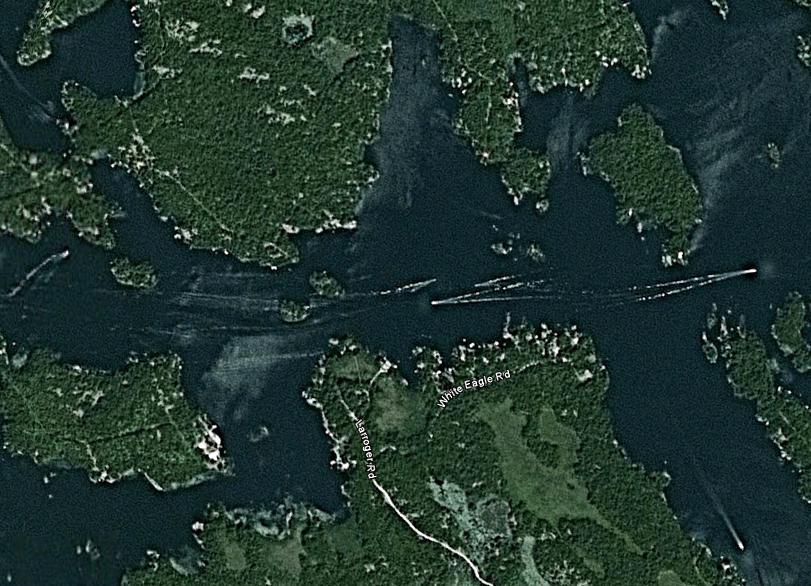
Observe the tracks of seven speedboats, indicating that, on the day this satellite shot was taken, this area is a major thoroughfare for speedboats.
Consider too that many boats will explore every nook and cranny on whim, so that canoeing off-this-beaten-track can also be frustrating.
We have often found lakes to be peaceful in spring and fall, outside the two months of vacations, and rivers are quieter during the two months (excepting, of course, for the Trent-Severn river system).
Abandoned Rail-Beds
“Another great clue for launch spots: Railway lines were often run along river or creek valleys; abandoned railway tracks provide launch spots wherever they cross a public road!”
This from our experience at Beaver River (Blackwater)
Loading
416-993-4953 CPRGreaves@gmail.com
Toronto, Friday, September 29, 2017 10:56 AM
Copyright © 1996-2017 Chris Greaves. All Rights Reserved.